Coltishall. Map Reference OL40 268205
Today a walk along the Bure Valley Railway path and return beside the river Bure. Parked at Coltishall "station" car park. Only 4 spaces here that you can park in. The "NO Parking" signs everywhere refer to the part as you drive in. But to your left when looking at the track you will see a "Bure Valley Walk Car Park" official notice. Alternatively there are several other places to park in Coltishall.
Walked West following the track. Navigation is very straight forward on this walk! The track follows beside the Bure Valley Railway which runs Nine miles from Aylsham to Wroxham and can be used by both walkers and cyclists.
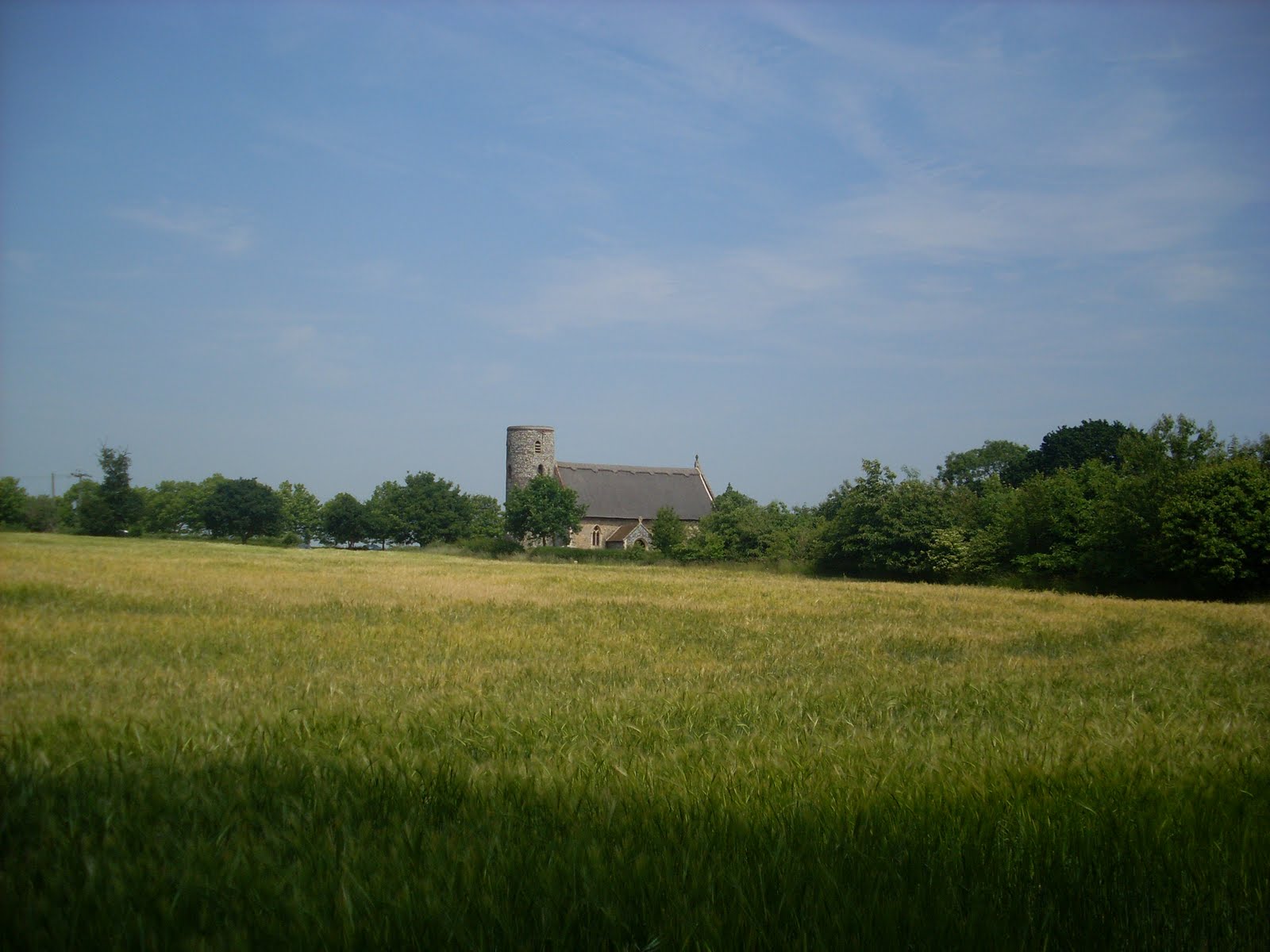
The walk takes you deep into the countryside with views across fields and past a rather austere Little Hautbois Hall which appears to be only accessible by a tiny track which has its own railway crossing.
Approaching Buxton at a bridge there are steps taking you down to the river where you can walk under the bridge and walk back to Coltishall beside the river Bure. When you cross a small lane with a bridge the footpath continues on the other side of the river (Northern Side). Follow this Eastwards to return to Coltishall near to "Coltishall Island" petrol station and shop.
An enjoyable walk and the River Bure is lovely.
Showing posts with label 4-6M. Show all posts
Showing posts with label 4-6M. Show all posts
Thursday, 29 December 2011


Friday, 2 July 2010
Big C Walk of Thoughts Somerleyton 270610


A charity walk today for Big C. The walk of Thoughts is held each year , starting at Fritton House it takes you around 6 miles of the Somerleyton Estate. This includes some formal gardens, the lake, woodland and open fields.
It is a time to reflect on friends and family lost to cancer, those fighting it and those who have had successful treatment. It is something that touches most of us and this for me is a rather wonderful way to think about all those people close to me and to see all the other people walking on this lovely sunny day for their friends and family,.Thank you Big C for organizing another lovely day.
Stuart
Wednesday, 5 May 2010
Norwich, Mousehold Heath, The Wensum, Rosary Cemetry, Lion Wood 040510


4.5 Miles Map Ref 243094
A circular walk in Norwich starting from Brittania Barracks on the North East side of Norwich with a fabulous vantage point to overlook this "Fine City." From here you see two Cathedrals, the "Roman" columns of City Hall, the City Hall Clock Tower, the Jarrolds printing works the whole panorama of this fine city.
This walk is taken from "Walks Around Norwich" by the Ramblers Association Norfolk and my grateful thanks to them. Ramblers publications seem always to be very reliable in describing their walk routes and they choose some excellent walks too. So look out for their little booklets and buy when you can!
The walk takes me through the trees of Mousehold Heath, I can still hear traffic in the distance as I am so close to some major roads but I am delighted to once again be surrounded with bird song celebrating this lovely day.
Following around Mousehold I am then directed to several paths, lanes and streets to bring me to Riverside road and the path along the river. The quintessential Norwich School playing fields with today a helicopter! I hear the Queen is in the City so perhaps its the Royal Flight! Bishops Bridge which was once the heavily guarded gateway to Norwich, Pulls Ferry and the lovely waters of the river Wensum.
From here I am directed up Aspland Road to Rosary road and then past the Chalkhill Brewery to Rosary Cemetery on the other side of the road. . You would not know without visiting that this large cemetery exists in such a built up area. It rambles over hillocks and troughs with many many trees. Most of the gravestones are weathered and green but interspersed are some very new, clean and bright ones. Some lean over at odd angles, some graves are slowly reverting to the earth. This is not to me a sign of neglect but a very powerful way of showing the passage of time and our own brief time on this precious earth.
I go through this extensive cemetery and cross a road to Lion Wood. Here I missed my directions and bore to my right too much to end up on the Yarmouth Road. I then had the "delight" of walking up the very steep Harvey Lane to get back to where I should be. Legs aching now! From there I return to that viewpoint of Britannia Barracks.
But despite this a very good day exploring parts of Norwich I had not seen before.
My last picture is taken as I enjoy a coffee in one of the many cafes by the market. Norwich is so colourful!
Stuart
Friday, 23 April 2010
St James to South Elmham 220410


St James to South Elmham Ref Ex231 319811
This walk is thanks to "Rural Rambles Round Halesworth" Walk No1 by Waveney and District Ramblers.
Park in the village hall car park, turn left out the car park, right at the junction and after 20 yards turn right onto a footpath and you are on your way.
The route takes you past wide open fields and skies, oak trees, hornbeam trees, bird song, derelict barn, small streams, spring buds, foot bridges(walkers love foot bridges, there is just something about them!), the ruin of a Minster, Old barns with bending beams and black sheep.
I work indoors in a hotel all day for several days so to suddenly find myself with huge blue skies, white clouds, and horizons that stretch for miles and miles is just so wonderful. Lungfulls of fresh air, no traffic noise but the delightful singing of birds. I have no knowledge of different species but always feel that as a human being I can in some way connect and be in tune with these creatures. On this enjoyable, bright and sunny day their song truly celebrates the the good fortune we share in being able to enjoy the day.
My path takes me past the ruins of a 11th Century Saxon Minster near South Elmham Hall. Founded by the bishop of Norwich. As I stand inside these huge flint walls, partly dilapidated now but still massive, still exuding a huge strength. I am in a very spiritual place, as good as any elaborate cathedral. Time to reflect and to give thanks inside these strong spiritual walls, blue sky above, trees around me and birdsong. Where better to commune with something bigger than me.
On through more open fields, lucky today, no cows despite several warning notices! Then on my return to the car park I am greeted by the unusual sight of the Coffee Caravan, designed to bring information to outlying villages and I am presented with a freshly brewed cup of tea, a seat and the hospitality of several interesting people. Now beat that at the end of a walk!
Stuart
Sunday, 21 March 2010
Great Glenham Suffolk Circular Walk 15 03 10 Ref 339612


Kindly dropped off by the church at Great Glenham by my wife, walked past the pub and followed the road out of the village until a footpath sign on my right. Along a track with some pruned trees in hedging covered in a green mould??
Past a semi derelict barn, looked like someone had started a project and given up. Wonderful views of open countryside.Pigs in pens, bridges across streams, large country houses, a path hacked through dead sweetcorn plants. Paths across bare earth fields with the path marked with small white pegs, what an understanding farmer to help keep us on the right path. Snowdrops lots!
Fairly easy going, level with mostly dry ground.
Saturday, 2 January 2010
Marriots Way. Norwich City Centre to Drayton 2nd January 2010


My wife said "you choose what you would like to do" and as she wasn't feeling so good decided to walk into Norwich and see some friends, Bill Wilson and his mates and then to walk the Marriots Way to Drayton.
The Marriots Way is a disused railway line cleverly and with thought turned into a long distance path by Norfolk County Council-well done!
As you walk out of the City and onto the path the traffic noise is still there but becomes a sound almost like the wind. But you then start to hear birdsong and the rustle of leaves and vegetation, you start to feel you have entered a different world and yest you are still close to the city. Its very good. Snow and ice in part. Traffic reappears as you go under bridges, you hardly have to cross a road, you are on a different transport system.
As you walk on you leave the city behind you and walk into open countryside, the river flows beside you at times, open fields, the odd horse with a blanket to protect from the cold seems content to try and munch some very cold grass.
Few landmarks but a church spire on your left tells you that the end is near and then good views form the A bridge as you cross the river and stride into Drayton.
Turn right and right again takes you to a good cafe for tea and some good cake.
2 hour walk, most enjoyable on my birthday. 7/10
Wednesday, 4 November 2009
Crettingham 04 11 0


TM 602229 Approx 4.4 Miles
This walk is courtesy of the Jarrold "Walks in Suffolk.

Starting at the village of Crettington, 2 miles south of Earl Soham the walk takes you over an upper tributary of the River Deben, through the local golf course on to Brandeston. You cross a ford, (there is a little bridge so no wet feet) and then return via Friday Street to Cretingham. Great views across rolling open fields. The countryside seems to be full of berries and pictured is a bush full of Sloes and even some pink berries which I am still trying to identify.


Monday, 10 August 2009
Dunwich beach and forest-Circular Walk-1.5 hours- 9/10
Approx 4 Miles
Park on car park on Dunwich Beach
Walk back through Dunwich to the church.
At this junction there is a signposted bridle path, follow this.
Pass cottages on your left and you will then come to a house on your right. At a signposted footpath by the house turn right. This takes you around the garden of the house then across boggy ground over railway sleepers. I like this part.
After the railway sleepers you cross a little bridge and are in the forest. Walk on for 100 yards and turn left onto a path through the trees. Not up the hill ahead.
Follow the path through the trees and enjoy the forest.
You will come to a stone bridleway /path at right angles to your forest path. Turn right going uphill. Continue along this path and eventually it will turn around to your left around a group of trees or just beforehand you can turn left through a well defined tree tunnel. As you come out of the trees turn left along the path.
Follow path, down and up and eventually you will come to a wooden seat with a path signposted left across a small valley. Take this left turn path.
Follow path down track and across side of a field until you come through a small wooden gate with a map signpost.
Path then is either turn left or straight on. Go straight on and continue until you come to another broad stone path at right angles. Turn left here.
Follow path for 100 yards until you come to another map board and take the path to the right through trees.
You will pass by a cottage in the woods and eventually come to the other end of the bridal path where you started your walk by the church.The path is signposted. Take this path to return down the bridleway to Dunwich church.
If by the church you turn left you can walk 200 yds to a little plant nursery with a wonderful tea broom with homemade cake. You will not be disappointed!
Hope Im not telling you to suck eggs but whenever I go near a forest I always take a compass. Otherwise the terrain can be very confusing.
If you do this walk I hope my instructions are ok and don’t get you lost!!
Afterwards you can always pop over to Southwold and sample a few pints of Adnams brewed in the town.
Stuart
Holkham to Burnham Overy- 210508- 7/10-4miles
Holkham to Burnham Overy
Wednesday 21st may 08 - 4 Miles - Ref 892440 -7/10
From the Victoria Hotel
Walking west along the dunes the path is not the easiest to follow, fairly uneven and you need a stick!
But all this is more than made up for by the glorious views of Holkham Bay
Following on as you come to the end of the trees on your left the “path” continues along the beach. Glorious but hard work on the legs. I am glad I am a Nordic walker and had my sticks to assist in my propulsion. The wind blew the sand along by my feet as I followed the path indicated by the footprints of a party of walkers I had seen walking the opposite way earlier. A bit of Robinson Crusoe in Norfolk
Turn left inshore at a gap marked by a footpath post to the top of the dunes, gets you puffing and then down to see Burnham Overy and Burnham Overy Mill clearly showing with its white sails.
The path gives good views across the marshes back towards Holkham and great views back seawards over the creeks, marshes and dunes.
You will find yourself greeting and being surrounded by bird watchers with their binoculars or large portable telescopes as this is a Twitcher’s paradise.
The path continues for nearly a mile to take you to the quay at Burnham Overy. The path is well made but the pebbles will make your feet ache!
So a fabulous walk for the views but not so good on the feet and legs! 7/10
Stuart
Subscribe to:
Posts (Atom)