Showing posts with label 2-4M. Show all posts

Tuesday, 1 May 2012

Coltishall 010512 3 Miles

Coltishall, Bure valley railway and a walk along the river Bure. A walk of celebration, today is a special anniversary for me.I did this walk on 260310 as a Walk for Health walk. Still lovely countryside, rolling fields, bird song with me for all the walk, delightful.

A health walk today starting from the Coltishall village hall car park in Rectory Road. Turn right out of the car park and then a left through Coltishall, past the pub, until turning left into a wide path, past a converted chapel, looked good, and onto a path overhung by trees. joining a road we eventually climbed a good few steps to take us onto the track of the Bure Valley Railway.
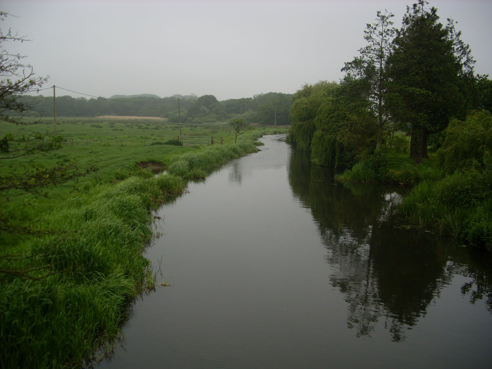
  This takes you under two beautiful red brick bridges and eventually to Coltishall Station where the stations buildings are now a Bed and Breakfast. Leave the railway here and a right turn at the end of the drive takes you back along the road to the Coltishall Island and the bridge. Cross a busy road and enjoy a wonderful walk along the gently flowing river. You can cross over the river by the sluice and return through a woodland path to the Coltishall Island and back to Rectory lane.


Friday, 25 June 2010

Coltishal -Health Walk-260610-3 Miles

A health walk today starting from the Coltishall village hall car park in Rectory Road. Turn right out of the car park and then a left through Coltishall until turning left into a wide path, past a converted chapel, looked good, and onto a path overhung by trees. joining a road we eventually climbed a good few steps to take us onto the track of the Bure Valley Railway.


 This takes you under two beautiful red brick bridges and eventually to Coltishall Station where the stations buildings are now a Bed and Breakfast. Leave the railway here and a right turn at the end of the drive takes you back along the road to the Coltishall Island and the bridge. Cross a busy road and enjoy a wonderful walk along the gently flowing river. You can cross over the river by the sluice and return through a woodland path to the Coltishall Island and back to Rectory lane.

A very lovely walk and my thanks to Ray our leader today and very genial host!

Sunday, 13 June 2010

North Walsham Canal 100610 TG346272 -3.5 Miles


Credit for this walk is to the Jarrolds Short walks series-Norfolk into Suffolk:the coastal fringe
This rates as one of my favourite walks. Number 10 in the guide and I do not think I would have found it without the guides help!
I do recommend boots or stout shoes and a walking stick for help over the sections of boggy path. I always wear ankle gaiters when walking and in the wet grass of the meadows these really proved themselves.
Your first challenge is to find the car park which is near East Ruston just past Barnells farm. Coming from Norwich you have to go roundabout a bit due to not many roads and waterways. See map reference.

From the car park a very short path,6' takes you onto the Weavers Way, a former railway line. Turn right and then at the gate by a cottage turn sharp left. Follow this track through a gate into a field. On the day I walked there were cows but fortunately on the far side and no hindrance to me. At a second gate continue along the side of the field. At the end of this field is a stump where a gate used to be. take a  diagonal path across the filed to a style which puts you at the edge of the canal and you can see "Tonnage Bridge" ahead of you.
      At the bridge, pause and enjoy the view of the canal if you are tall enough to peek over the wall! The bridge was restored in the 80's. The question I ask is why was such a substantial bridge put there in the first place? Perhaps the horses pulling the barges crossed the river here.
Walk over the bridge and immediately turn right through a gate to follow the canal northwards. Then enjoy a walk of open fields as you follow alongside the canal. Parts of the path are only inches above the water level making the path very soft in parts and highlighting how fragile parts of this land are. You will come to a copse of Alder trees on your way.
A plank bridge leads into a wood. On the day of my walk all the wild Iris were in bloom so I was greeted with a wonderful yellow display.
Soon you will hear the sound of rushing water. Is this a waterfall in Norfolk you may ask? Well its the best equivalent as you are approaching the lock at Honing. The gates are long gone but there are still heavy pieces of steel and some great brickwork viewed as the water rushes down and then becomes still once more a few yards along the canal.
Cross the bridge at the lock, through some trees and you come to the Weavers Way once more. Turn right, eastwards for a one mile walk back to the car park.
Have you enjoyed this walk? I would love to hear your comments!
See also The North Walsham and Dilham Canal Trust
Stuart
Addendum-My lovely special friend- Liz
On the day of this walk I went to Gorleston later on to taxi my very dear friend Liz back to Beccles from the James Padget Hospital. Liz had just had a session of Chemotherapy at the hospital. On the way back we had such a laugh together and she treated me to a cup of tea at her new house. Liz was always so bubbly and chatty, she made the most of every single moment.  Sadly a few days later, Liz had a massive stroke and died shortly after. I will miss her so much but am so grateful that on the day I enjoyed the North Walsham Canal I also enjoyed that precious time with Liz.
 Live your life, live your day, God bless you Liz xx

Saturday, 29 May 2010

Pulham Market Health Walk 270510

A health walk today form Pulham Market just off the A140, south after Long Stratton.

A beautiful thatched village complete with thatched pub, The Crown. From the green we went East along Barnes road into the countryside and then into the delightfully named Duck's Foot road. Eventually a track on our left took us onto Boudica's Way. This long distance path runs from Norwich to Diss. On reaching Boudica's way we then turned south to head back  to Pulham Market. The path meandered alongside a stream with a great little one plank bridge, well made and with substantial hand rails, we emerged by the Pulham Market bowls club. A lovely piece of countryside. Coffee afterwards in the pub, The Crown where the landlord was a good host and made us welcome. I may well return.
Behind the pub is a wonderful church with a superb wooden roof and mural, well worth a look.
Feedback welcome!
Stuart

Friday, 14 May 2010

Marriotts Way Health Walk 140510

This  Health Walk took us from the car park in Westwick Street, across the road by Halfords and then along the Marriotts way footpath, originally the railway line into Norwich. Suddenly you find yourself leaving the busy traffic and you are surrounded by lush green, trees and birdsong, the traffic has become a quiet rumble in the background. The footpath follows the river Wensum, taking you past industrial units but still you remain in a green corridor. Norwich should be proud how this this lovely established route has been kept for walkers and cyclists to enjoy. On your way the first bridge you come to allows you to turn right and cross Andersons Meadow. From there you can cross the road (Mile Cross) walk over the bridge and there is a gap in the fence leading you down to a path by the river and many trees. You can carry on here, do a loop and return back down the track. Make it a as long or short as you want.Its lovely!
This is a link to Google Map. The walk starts form the car park in Westwick street by the junction with Barn road. next to New Mills Yard. Fingers crossed that it works!!

View Larger Map
Stuart

Thursday, 6 May 2010

Ashby St Mary near Thurton, Norfolk 060510


2.4 Miles Ref 022329
Today took me just off the A146 at Thurton to Ashby St Mary. Parking with narrow lanes and no village hall. I do love village halls for their easily accessible car parks during the quiet mid-week. I eventually squeezed myself on to the edge of a field entrance trying carefully to avoid obstructing Mr Farmer.
The path starts near the side of the church and takes you northwards to Claxton. Unusually for Norfolk this area is partly rolling countryside, paths go up and down and the views are superb.From Claxton I made my way to St Andrews the church of Claxton where someone had kindly installed a bench for me to enjoy lunch on, in the sun but shaded form the cold wind. I had to put gloves on today despite the sunshine,.
Footpath difficulties!
Leaving the church behind me I  crossed the road and followed the footpath sign but where the path went seemed very unclear. Navigation by pylons took me to a point where I could see the path I needed would intersect but it took a bit of walking across ploughed fields to get there. The next footpath was clearly marked with a new post and took me across an otherwise unmarked growing crop. Without the post I would have been a bit stuck and without these markers parts of the countryside could slowly become lost to all of us.

A good walk , navigation challenges are interesting and often give me a  great sense of achievement once I have eventually found my way.
Often I tell myself "Perhaps your map reading skills are not as good as you thought!" But then that spurs me on to get some more practice in, don't panic, look at that map and what is around me! Landmarks, contours, fields, woods, everything and don't panic!
Can anyone tell me what these pinky blooms are?
Stuart

Friday, 30 April 2010

Buxton, Norfolk 30 April 2010


This is a lovely 3 mile walk alongside the river Bure in Norfolk.Grid Ref 224226. There are several styles.
Originally I saw this walk in the EDP Walking section which is an excellent feature.
I parked in the village hall car park. There are signs for  a car park but I think it has been built on?


Turn right out of the car park and walk underneath the rail bridge. Carry on towards the Mill. Just before the Mill there is a path on your left. I did not find it easily but if you follow the line from the footpath on the  opposite side of the road it is clearer.
The path leads round the back of some houses and is then quite narrow with several tree roots but also quite magical. There are good views along the river towards the Mill. After a style the path becomes broad and follows the twists and turns of the River Bure. The path is only a foot or two above the river and I felt at one with the wonderful countryside I was presented with.
Today I saw two Heron as they took off up ahead from the side of the river, their long scrawny legs trailing behind them and that instantly recognisable beak. (I am not very knowledgeable on bird species but do enjoy seeing them in their habitat and of course their songs. Music to accompany me on my travels.) Two Monkjack Deer were on the other side of the river running really fast and making such a strange noise. Bonus Ball!!
Mr Pheasant also appeared and I love to hear their throaty call when I am out and about.
After just under 2 miles there is  a bridge  where small horser/ponies?? were grazing. Turn right and through a gate to a path across the field which takes you to the Bure Valley Railway which has a path alongside it. Turn left and take the first set of  steps down to Mill Road. Turn right and back to the village Hall.
A  walk of  3 miles, wonderful countryside, no traffic noise, the flow of the river. Does it get any better than this?
Afterwards I stopped a the Crown Pub for a refreshing drink and time to write up my walk.
Stuart

Friday, 16 April 2010

Horsford 7th Birthday Health Walk 16 04 10 TG191168

Today we celebrated 7 Years of Health walks with a meet up of 98 at the Brickmakers Pub. Having manged to squeeze over 50 cars in we set off doing a circular walk around the back of the pub, many horses and then for those of us on the longer 3.8 mile option we crossed the main road and into the woods.
Walking in the woods always gives you that very atmospheric feeling, the wind in the trees. No one got lost as we were able to stay in sight of front and back markers and enjoyed  the paths. I have found woods can be very disorientating and its very easy to get lost if you not have a compass as all looks the same and there are no reference points. A good mornings walk and coffee, cake and a distribution of literature in the pub afterwards. Everyone was very jolly!!
Stuart

Friday, 13 November 2009

Diss Health Walk 12 11 09


Thursday 12th November 2009. TM117796
Fortnightly "Walking for Health" walk from Diss Mere out to Walcot Green and return. 2.6 miles.
Cracking morning of bright sunshine and good conversation. Coffee afterwards at No 13. in town centre. Very good.

Friday, 14 August 2009

Yelverton Norfolk-140809- TG293022-2.5 miles-7/10

A Health Walk from Yelverton , Norfolk. Footpaths alongside fields with good views and through wood with enclosed tree tunnel .Most enjoyable. 50 minutes.
Stuart

Monday, 10 August 2009

Thurne to Repps 100408-2 Hours-Ref 403158-7/10


Thursday 10th April 2008. Approx 3.6 Miles
Thurne , Norfolk. Situated on the river Thurne, near Potter Heigham
Map Reference 403158
Thurne to Repps and return
2 Hours approx
Great walk 7/10
Going, flat but very uneven, walking pole recommended
Started at Thurne where parked car.
Very picturesque dyke with 3 windmills on view, Glorious views across the countryside.
Start with dyke on your left and follow path round to your left along the river bank.
Walk along the river beside reed beds. Old brick built water mills... Boats and sailing boats, Past Womack water which leads to Ludham. “Toad Hall” is at this junction.
Onto Repps where the picnic site provides a marvellous seat by the river with views left and right. Some very interesting riverside huts and houses, some very palatial!
Turn right along a lane, past hall Farm to a signed footpath crossing the road. Turn right over fields towards a wood.
Cross bridge over dyke into woods, follow path, ignore the next bridge and continue.
Saw several pheasants and a Deer in the distance, Monk Jack I think.
Smelly piggys!
Followed path to crossing of tracks, turn right onto bridleway, walk past cottages, lovely pond, to third cottage where footpath goes off to the right taking you round their garden. Then follow footpath across fields to get you back to Thurne.
And Lion Pub.
Pub looks a little in need but landlord and staff give an excellent welcome and make you feel at home. I will return,
Stuart
10th April 2008-04-10

Reedham Norfolk 150508

Reedham Approx 3.4 M
Wednesday 15 05 08 Ref 422017


Parked at Reedham Quay (Free). Walked along the quay with the River Yare on my right towards the wonderful railway swing bridge.
Follow the road as it bears left uphill by the pub ad at the school turn right into
Holly Farm Road
.
Enjoy wonderful views across the Swing Bridge and marshes. You are looking south over Norton Marshes towards the very slight hill in the distance of Norton Subcourse and Thurlton.
Follow the lane to see glimpses of the Yare travelling North East ahead of you.


The lane bends sharp left leaving the clearly signposted Wherryman's Way to your right. Climb up onto the bank of the Wherryman way to see the three drainage mills, one wit sails, the North, Polkey's and Cadges drainage mills. Marking the path of the Wherrymans way as it follows the river Yare to the Berney Arms and on to Great Yarmouth.


Down form the bank, bear left round the bend along delightful lane whose hedgerows are bursting with new growth... Just before the level crossing turn left along a marked footpath. There are two paths parallel to each other, take the path on the left. Enjoy a shaded walk with views on your right across the marshes towards Fritton and St Olaves.
When you come to the road turn right, go past the school and then left down the hill to return to the quay.
Follow the road along the quay with the river on your left, past the war memorial and you come to some steps leading down to a path that takes you to the river bank.
Follow the river bank with views across Morton Marshes to the Ferry Inn with its chain link Ferry offering a shortcut to Beccles, Bungay or Lowestoft.


The Wherryman’s Way continues past the pub on the same bank to the junction of the River Chet which goes into Loddon and is marked by a stone cross. At the time of walking I was unable to go this far due to flood protection work blocking the path. At the closure fence you can see directly ahead Norton drainage Mill which marks the junction with the river Chet.
Returning past the Ferry Inn take the road for views across the marshes s towards Cantley and the dominating sugar beet factory. With the derelict Limpenhoe drainage mill marking the course of the river Yare.
At the station stop at the Garage Café, open all day, just ring the bell for home made cakes, very, very good and a proper pot of tea to refresh you.
From the café turn right past the now redeveloped “Railway” Pub for a view down to your left of a still functioning signal box full of shining metal levers and I’m sure a lot of history.
Turn right at the junction and at the end of the road take the path at the edge of the field. At the road turn right then left by the war memorials to return to the Quay. The memorial reminding you of the people form this small community who lost their lives in the two world wars and makes you pause to think how that must have affected all those living here.
Return to the quay and another wonderful view of the swing bridge set on this river by open marshes.